Monday, June 26, 2023

Sammy the Sloth (Trailname: Samsquatch)

My friend, Beth, inspired me. Yes, every ounce matters when you hike; but playfulness matters too. And the fun pictures she'd take on our trips of her various stuffies made me think, "I need one too." 

I looked a long time, but couldn't find the right fit. Then after I finally bought a sweet faced sloth on a wintry day in Winthrop, I lost him on our first outing. Maybe I was just too much of an irresponsible sloth mom to be entrusted with such cuteness?

Then Sammy came into my life. A gift for my 55th birthday, it was an easy choice to name him after the rock legend who made "I Can't Drive 55" famous. Sammy immediately came with us on my B-day hike, and right away he felt like a good luck charm.

"Welcome Pass" was our second hike together, where he cheered me on to get up those unrelenting 66 switchbacks so he could get his picture taken at the top. (I knew I shouldn't have trusted Heidi's promise of "it won't be so bad"...I've told the same lies myself. We hiker addicts live in elevation gain denial ;))

And of course I had to buy him his own post hike beer, even though being carried really shouldn't earn you one.

Though Sammy did earn my undying gratitude when he convinced my husband to come on a spontaneous road trip for Father's Day, where we did our first hike together in five years. In 2018 Ken came with me to hike the last few days of my Appalachian Trail adventure (buy the book here - 5 star rating with 36 reviews and counting!) but those final cruel downward 8 miles did a number on his bad knee. Blue Lake was a good test to see if the surgeries have helped much, and though the knee hurt a little, he was in great spirits.

Ken even came up with "Samsquatch" and had some great ideas for a few photo shoots, which surprised and delighted me. Playfulness is infectious, and we need more and more contagion the older we get. May there be an epidemic! Happy "be even more silly as you get older" trails. 

Ken's idea with his glasses :)
Things to know about both trails below. 

WELCOME PASS

1) Heidi blamed the "moderate" rating for fooling her, but 2,800 feet gain in 2.3 miles should have been a big red flag. Hey, I ignored it too...it's not like I haven't done that kind of elevation gain before. But the first mile is pretty flat, so it's even worse than a thousand foot gain per mile after that. Prepare to suffer.

2) Don't use a driving app to get you there...Google and such are very confused about this area. (The same is true for Church Mountain, btw) Turn onto forest service road 3060, which will be on the left between milepost 45 and 46. It looks like you are driving to nowhere, but I promise there is a decent trailhead there.

3) Still a bit of snow at the top, but this hike is one of the few places I can think of to get to 5200 feet this early without hitting snow. Lots of ridge walking opportunity soon, but I wouldn't want to do it mid-June unless you are really comfortable with snow crossings.  

BLUE LAKE

1) This hike is POPULAR - how could it not be? Right off Hwy 20, only 4.4 miles round trip with pretty steady 500-ish foot gain per mile that gets you up to 6,000 feet with a spectacularly blue lake. Plus it allows dogs...I mean, you WILL have company. But it's a NICE trail, with lots of room to pass each other. 

2) Climbers use part of this trail to get up to Liberty Bell. Ken spent his 21st birthday hanging off the side of the thing, so it was fun for him to reminisce; but it's hard to leave the hard core days behind. 

3) No camping allowed at this lake, but I did notice a great spot less than a quarter mile into the hike. You'd have a parade going by; but it could be a good late night or early morning save. 

4) Speaking of camping, and if you are wanting to do a spontaneous trip on a long weekend and don't have reservations; Hipcamp is a great resource. We found a great spot at Silverline Lake Resort in an "overflow" field. 

BONUS THING TO KNOW

There is a nice hike just across from Silverline - unfortunately I can't remember the name, and it's not on WTA. It's more of a biker trail, but plenty of people were hiking it. It has great views of Lake Pearrygin, and so many wildflowers. It would be a wonderful show of Balsamroot in the spring. You can access the trail straight from the campground...here's a pic of where you cross over and bushwack a little up to it. 

I think the cross over board is at site 43. 
You can see the trail up above. 


Friday, June 16, 2023

Happy Birthday to Me, Again

Another birthday on the trail! Though for my 55th, I decided I wanted to let up on the suffering part. (Last birthday trip here ) My friends and I decided that all of us chipping in and renting a VRBO house in Port Townsend was a perfect way to celebrate; and with two cars and their help, we could get another 10 miles towards my PNT mile goal as we day hiked a point to point from the Tubal Cain parking lot to the Mount Zion trailhead, which is not far from Port Townsend. Browsing the rental options, I found an affordable cabin on the beach with just a five minute walk to the ferry! But "too good to be true" is an idiom for a reason. Somehow I had failed to notice this rental was a five minute walk to the CLINTON ferry - on Whidbey Island. Oops. 

Wrong ferry - still beautiful
Thankfully I at least noticed this a week or so out, so after about a million group texts, we came up with a new plan. It seems to me that as you get older, you either perfect the art of pivoting, or you get grumpy as hell when things have to change. Actually, it's surely a mixture of both - but I hope and pray I continue to lean towards going with the flow. The Spirit has taught me many times that a "mistake" is often just serendipity in disguise, if you can accept it. Therefore I wish you all happy "veiled fortune" trails! (I know my hiking log below is more of a girl's trip plan; but hey, if you are planning a little getaway - it's a good one!)

Ebey's Landing is always a favorite

Day 1: In my car, Heidi, Julie and I met Janet in her car at the Coupeville ferry terminal. This is one of the few places you can park a car for free for 24 hours, and because we wanted to save on ferry costs, we left both cars and just walked on. We had a reservation at the "Soak on the Sound" which we were going to walk to from our supposed Port Townsend rental so we could have cocktails without worry. Well, obviously we worked hard to keep that part of the plan in place. ;) Once back at our cars, we left mine for the next day's hiking plan and took Janet's to our "wrong beach" getaway. 


This is actually before the margaritas! We are naturally goof balls.

Day 2: We drove to pick up Rebecca at "The Happy House" so we could hike together. (Too much to explain Rebecca, but you can read how we met here if you'd like.) We started at Fort Ebey to go west on the PNT because last time I went east. (Story here )

Rebecca was an indispensable guide, as where we expected to head down to do the "official" beach walk we found a greatly washed out hillside that did not look 50 year old friendly. Time for another pivot. Rebecca assured me that the Whidbey Island section of the PNT is definitely a "hike your own hike" portion, so even though whatever crazy zig-zag way we ended up taking was "unofficial" - I am counting those miles! 

Bring a map if you're not doing the beach-
it's a maze at Fort Ebey!

I have no clue what we actually hiked- but here's a clue
Plus we loved them so much better than a 9 mile beach walk; we were even able to stop in at the historical house at Ebey's Landing which was open to tour. (My second time, but their first. Story here) Finally able to connect to the beach walk, we actually had to wait for a few minutes for a wedding procession. The day felt special in so many ways. 

Really interesting and sad history here

Who doesn't love a beach wedding?
By the time we made it to my awaiting car we were starving and opted to eat right there at Callen's Restaurant. I've always been curious, yet suspicious of this place; but I can assure you it has amazing food and service. 

Day 3: Just a lazy day until we reluctantly had to leave, but I'll leave you with a couple tips if you decide to check out the area sometime: 1) Possession Point at the tip of the island is not much to see, and you have to basically walk through someone's yard to get there which is really weird. 2) Langley is a very cute town worth stopping at - though don't get there before noon if you expect to eat. If you have money to burn you could stay at the "Inn at Langley"...but don't stop to ask about their restaurant if you don't. It will be painfully obvious you are not welcome. The "Ultra House" opens a little early at 11:30, and if you like authentic Japanese ramen, it is the place to be. 

I'll introduce you to my birthday gift,
Sammy,
next time :)


Wednesday, May 31, 2023

Don't Be Delusional


I got 28 more miles on the Pacific Northwest Trail this past Memorial day weekend. Extra days off work pretty much mean I'm hiking, since it's hard to take time off now that I'm full time with benefits. I'm not complaining, the benefits are a game changer - I'm totally grateful, even if work dampens the free spirit vibe I'd love to permanently live in. Though I dive pretty hard into the fantasy of living wild on the trail whenever I'm doing it; even if it's just for a few days. 

Now that I've hiked most (but not all!) the PNT miles in Western Washington that aren't road walks, I need to venture further east. Thankfully I have friends who frequently travel over the mountains to camp and are willing to be trail support for me. I really don't think I could do it otherwise. It's not like the smattering of remote farming communities have Uber drivers who could take me back to my awaiting car. Most the time there isn't even cell service! And doing up and back hikes when you are counting miles gets pretty frustrating considering you can only count half of them.

Osoyoos Lake
Speaking of doing miles you can't count, I mistakenly did two of those on this trip. There is a lesson I'm struggling to learn, on trail and in life...that would be the "cut your loses quickly by admitting you fucked up" lesson. I did manage to do it early on in the trip and saved myself from sure disaster. A downed marker made a grown over right hand turn nearly impossible to notice. I only realized something was wrong when providentially a Y in the road came soon after and forced me to realize neither direction was keeping me on my Guthooks red line. (Guthooks is a navigation app I discovered when doing my 500 miles of the AT. They changed the name to "FarOut", but I refuse to comply ;)) I HATE turning around, and may have kept pressing forward to try and make it connect somehow (it's over there somewhere...) but the forest started closing in and I knew better. (Video here)

Whistler Canyon Trail
But mistake #2 was of the delusional variety; when you want something to be true, so your brain shuts off logic. I didn't want to do road miles, so when I found that the PNT joins the Similkameen trail just outside of Orville, I was quite pleased. And it was a nice trail! Right by the river with surrounding orchards...and wow, it's going to cross on a really cool little bridge!

Similkameen Trail
The thing about FarOut (okay, I'll comply...maybe they will sponsor me!) is it's not always EXACTLY right on. (Which can be frustrating and scary if you have completely lost the trail - like I did on the PNT section from Whatcom Pass to the Little Beaver intersection...story and video...of course this is why you should have real maps as back up. Guilty as charged.) So as I excitedly went down to the cute bridge and noticed I was a little off the red line, I excused it as FarOut's error. "Certainly they mean for me to take this nice little real trail that parallels the road, and then I'll connect back to the road a little further in" my starry eyed self insisted. This is despite the fact the red line does not cross the river - a huge red flag I refused to acknowledge. 

Stay up here, dummy
The worse part about a delusional mistake is the more you commit to it, the harder it gets to admit it. A mile in may not seem too bad, but it really is when deep inside yourself you know; but you won't listen. Sadly I can think of too many times that stubbornness has cost me far more than two miles. 


Thank God I finally did pull my head out of my ass and made it back to the road (video) before my support crew drove by to pick me up and couldn't find me - which really would not have been good. ( No cell service, remember.) 

Thank you, Anita and Chris


A detailed itinerary is below for those interested, but I'll end here wishing you all happy "mistake free" trails. 

TRAIL LOG:

Day 1) This was just a travel day, but I mention it here because it's a LONG drive and does pretty much take a whole day if you live in Western Washington. My friends picked me us straight from work at 2pm and I camped with them that night so they could drive me to the TH in the morning. 

Remote camping on BLM land
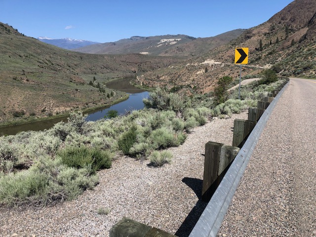
Day 2) Got a bit of a late start around noon at the Wilcox TH, which was fine because I only had 8 miles. Very nice road to get there--but the trail itself is not great. Much of it is an active logging road, so I was glad it was the weekend. There is NO camp on this trail I would ever want to stay at except the bench lookout - but it's close to perfect. No water though, so be sure to haul it in. If you go west like me, it won't be hard, because it's pretty much downhill from start to finish.

Day 3) First 3 miles are rough - a mosquito tunnel, and I'm pretty sure they are just starting to get bad. The campsite I passed would be HELL to stay at - SOOO glad I planned it so I didn't have to. But soon you get to the views, and then before you know it you're at the Whistler Canyon TH after 7 miles total. Then it's about 3 miles into town, and then another half mile off trail to Osoyoos Lake Veteran's Memorial Park. Really nice campground with awesome $18 walk in sites right on the water. FYI, I doubt you will ever need a reservation for those because all of them were open on a holiday weekend. 


Day 4) The half mile back to the trail, which quickly then brings you to the Similkameen Trail just outside of town. Kind of weird at first, with some dumping grounds along the side, it does become pretty after about a half mile. At two miles you get to what I've read is the more "official" TH, which has a great sign talking about how this is the PNT. That's also part of why I got thrown off; thinking it meant the whole trail was supposedly PNT miles. It is a nice little trail that goes another two miles and ends at the Enloe Dam overlook. (Which does not allow for walking across and connecting to the road, of course.) Anyway, for me, after turning around and getting back on track, I did 8 miles or so - so I'll just say a total of 10.3 so I can call the whole trip an even 28 miles. Close enough ;)

One of the most poop filled trails I've ever seen. 
Lots of Elk and other wildlife in this area.


Wednesday, May 24, 2023

Manly Manastache

So this whole weekend was about going ANYWHERE, because Heidi's been working too much. Plus she needed to give her new knee a real test, having had a partial replacement just a few months ago. I wanted to give my new backpack a test too - so we didn't want to do anything too hard, in case either didn't perform quite the way we'd hoped. 

Ancient Lakes is a go to easy early backpack that I haven't done yet, so it seemed a no brainer. Forecast looked good...then even better...then wait, that's a little warm...then hell no, we're not going to that desert wasteland in near triple digit heat. 

Heidi has to take a picture of EVERY flower, haha
She takes good ones though!
So now what? I had already booked a Hipcamp spot for us to stay near Leavenworth Friday night so we would have time to get a Balsamroot experience before heading to Ancient Lakes on Saturday. (And wow, did we get one! Story here ) So needing to find something to fit into our original Hwy 2 / I-90 loop plan, I simply visited the Washington Trail Association page, selected a few filters on their "Hike Finder Map," then clicked away until I found something I liked. (Thanks WTA! They have an app as well, FYI) Manastache Lake looked to be perfect fit, and we only needed to drive about an hour outside of Ellensburg.

The Hipcamp Spot is overpriced, but what isn't around
Leavenworth? And it does have the world's largest firepit. ;)
Though after going "the speed of flowers" all day at Twin Peaks, we didn't find ourselves at our new trailhead until 5:30 pm. Thankfully there was an even easier option of only going 2 miles to the first "Lost Lake," but you know what a super easy backpack-able lake on a Saturday means, right? Yep...we counted a dozen tents in the large area with ALL boys...mostly young boys. Loud, excited, and now free to run wild in nature boys. 

Maybe the boys cleared the trail? Whoever did...
THANK YOU
Believe it or not, there was still room for two old ladies to squeeze in - but we sure didn't feel like we belonged at this party. So we kept moving and PRAYED there was another spot further in. 

Last site on Lost Lake. Thank you Jesus.

With a gorgeous view...but LOUD frogs. 
Maybe even louder than the boys?
We left our salvation spot in the morning and then day packed our way up to see the HUGE Manastache Lake. We made it all the way to the end, despite some route finding and snow challenges - I mean, we had to see the fishing bench I read about on those trip reports.


Of course the camp spot there was already occupied by boys as well...but only two, of the "men" variety, who were kind enough to let us barge through; one even took a picture for us.

Nice guys; though they didn't bring us
 our morning Bloody Mary's as requested  ;P
So the 2 miles to Manastache, then the 2 back to our tents, then the last 2 out to our car made a perfect day with plenty of time to drive home. Both Heidi's knee and my backpack performed beyond our expectations, so we are hoping to get a few other more challenging hikes in this season. My "Things to Know" list below as usual. Happy "get away from the boys" trails! ;)


Things to Know:

1) The last 9-ish mile non-paved road feels like FOREVER because it's badly washboarded and you have to go slow. Any car could make it though, and the parking is pretty large and it has a decent toilet. 

2) This is MOTOR bike territory; probably it's biggest downfall. But we didn't even see one, most likely because the snow isn't fully melted out. So this is the time to go - plus there were NO bugs...but that will certainly change. 

3) There are two (dare I say lovely?) meadows that will be full of wildflowers soon, but no Balsamroot as far as I could tell.

4) The trail is simple to follow, except it has one intersection with signs that only have numbers. Turn left.