Wednesday, September 21, 2022

Complicated Swift Creek Plans

I am queen of the complicated plan. Doing small sections of a long distance hike means you need a drop off crew and a pick up crew. This may require a bit of finagling...or downright bribery. Lately I've been paying my adult children quite a bit of cash for these services; but hey, hobbies/addictions are rarely cheap.

My hiking partners, Callie and Sarah, were game to throw caution to the wind and gamble on getting a hitch, but ultimately I played it safe and paid off kid #4 to come get us. Although, we did end up accepting a ride from two jovial hunters to help us get down off the forest road that was sure to really piss off said kid who does not own a "forest road approved" car.

Yep, this plan just kept getting more complicated...I do reign supreme. Be as it may, I am now 10.3 miles closer to my 500 mile goal on the PNT. (My third long distance trail out of five I hope to get 500 miles on.) I'm slowly getting there - one mile and one dollar at a time.

My "things to know" list about Swift Creek is below for those interested.
Happy "expensive but worth it" trails.

Things to know: 

1) The trail is totally brushed out and in great shape! THANK YOU PNTA TRAIL CREWS!

You all rock!
2) If you prefer hiking down better than up, you'll want to start at the Lake Ann TH on Mount Baker. (Kid#1 got bribed for that drop off.) I expected a much steeper decline, but the first couple of miles after the Swift Creek intersection are mostly a traverse, with much better views than I anticipated. It is also LOADED with berries!!

Hard to hike when you are picking berries

Decline + old knees=learning to use KT tape

3) Bear!! Just a little guy (though he did give us quite the startle!) - but where is momma? Eek...this is when we realized none of us really knew how to operate the bear spray can. So heads up, maybe check out those  directions first. ;) 

"Maybe we should read this"
4) The creek crossing is not bad this time of year, though still a bit of a challenge. The place to cross is not obvious, and you really can't see the trail on the south side until you are right on it. (Our side was marked with some pink tape.) Thankfully this is when we first met our hunter friends, and they let us know it was the best place to cross and the trail was right there.


 5) The other crossing has an awesome log to cross on. I HATE log crossings, but this one is actually fun. It's HUGE!

Looks scary from below

But it's not
6) The end of the trail dumps you out with no sign to go right or left. Go right (which is up - feels counter intuitive) and you'll soon see all the disgusting garbage to let you know the Hot Springs parking lot is near. The actual Hot Springs are another half mile-ish off trail, and thankfully not as disgusting. 

Cheers to slime and stink
7) You can hike another 4 miles of PNT road walk down to Baker Lake Road to avoid all those pot holes, which was my original plan. Soaking in the springs was a better plan, except now I'll have to get those 4 miles somewhere else. Though there was NO WAY we would have had time to make it to the road by the time I told my daughter we'd be there...which is why a Garmin is good to have to communicate change of plans. There is no cell service at all once you leave the Lake Ann Parking lot.


Saturday, September 10, 2022

Down to Earth at Marmot Pass


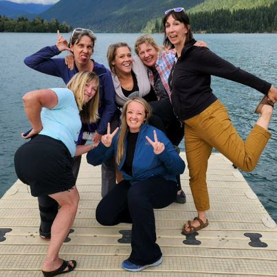
I invited a thru hiker, who hikes 30-ish miles a day, to do a backpack with me...me, the self proclaimed "slowest hiker." What was I thinking? But Twig said she wasn't hiked out! She had finished the 1200 mile PNT, and yet she was asking if I could loan her some pants so she could summit Mount Baker. ("Can't climb volcanos in a dress apparently," she messages me.) Of course I was falling all over myself trying to do anything I could do to help her out - being an obsessed fan and all. (Explanation here

To further clarify, after our chance meeting on Whatcom Pass, Twig DM'ed me after reading my story on the PNT Facebook page and we hung out for an afternoon when she was hiking through my area. I'm thankful the hiking community is not very fertile ground for the "celebrity" mindset that can so easily take us over. Hikers are far too down to earth for that - quite literally, covered in earth. So it wasn't too hard to go from worshiping Twig, to feeling like she was my friend. But hiking together? That was probably a bit delusional. (Maybe if she carried both our packs? ;))

Of course it wasn't summiting Baker that I was inviting myself to (egads, no! She had wisely hired a guide for that) but Marmot Pass. Since she sounded as if she still wanted to hike while she was in the Pacific Northwest, I thought she may want to come with if she hadn't already done it. Marmot Pass is part of the PNT, which was my main reason for choosing it; but there are a few alternate routes through the Olympics, so I knew it was possible she may have skipped it. (She didn't...but you can read her blog for details https://twigadventures.com/ )

It turned out Mount Baker had at last filled her hiking tank, but I'm glad I asked her. Even though we didn't hike together, I was able to give her a ride to where she needed to get to before flying back to Florida, being it was right on my way. It even worked out for her and Wolverine to stay at my house the night before leaving - I believe I can even call myself an official "Trail Angel" now! It was all so fun and exciting that I haven't written one word about the actual hike! I will do that below in my trail log, but my ending blessing here will be "happy down to earth trails, that might even include angelic opportunities."  

Of course they fell in love with our bunnies!
Who wouldn't?
Trail Log:

Day 1: A few feet to the shelter at Tubal Cain. This is one reason I was really trying to get someone to go with me - I do not like camping alone near a road for obvious reasons. But I knew I couldn't get there until 7 pm at the earliest, so camping at the trailhead was a necessity. I thought I might even sleep in the car, but I still had light enough that I felt comfortable setting up camp. (The forest road up is pretty nice, and I drove it far faster than Google estimated.) And even though there is graffiti on the side of the shelter, it's a nice spot, and I had to myself. I took a long morning and sat in my camp chair and played my ukulele...then I was able to simply walk those items back to my car. 

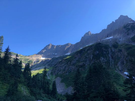
Day 2: Hiked the 3.2 miles to the Tubal Cain mine turn off, then the steep half mile up to check out the plane crash site, then a little further up to where it opens up to some nice views. I kept thinking I'd see a mine shaft, so I kept going, but finally gave up. On my way back down I asked a group where the trail leads, and they said they were headed to Silver Lake. The map does not show this, so beware if you try that! Oh, and the mine shaft is exactly at the turn off! I don't know how I missed it.


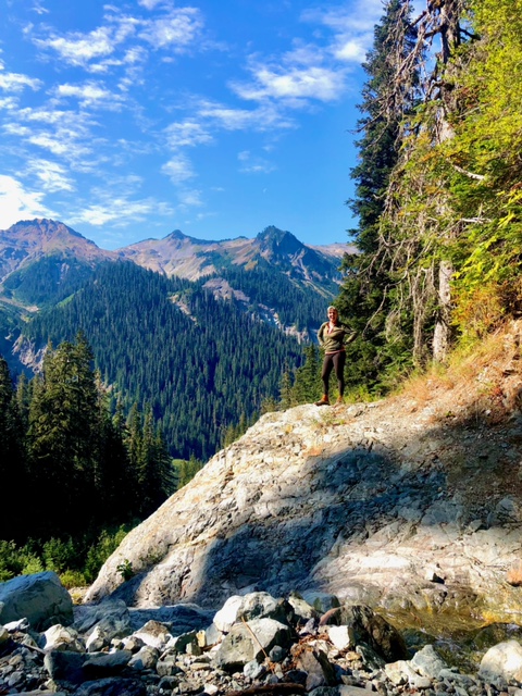
Once I was back at the main trail, I continued to the Copper Creek Trail Camp and got completely lost. The trail EXPLODES here with rabbit trails everywhere! It is REALLY confusing, especially when someone sets their tent right over the trail, making it look like just another path to yet another camp spot. Keep going right, even though the creek splits and looks like it's going left - you'll cross it on the right. Then the trail heads in the opposite direction, but thankfully there is a sign there to confirm you are indeed going the right way. It's an impossibly long switchback, but you'll eventually start heading the right way. I camped on the ridge heading up to a view on Marmot Pass, which made about a 10.5 mile day, including the side trip to the plane. 


Two rainbows in one day!


First light from my tent

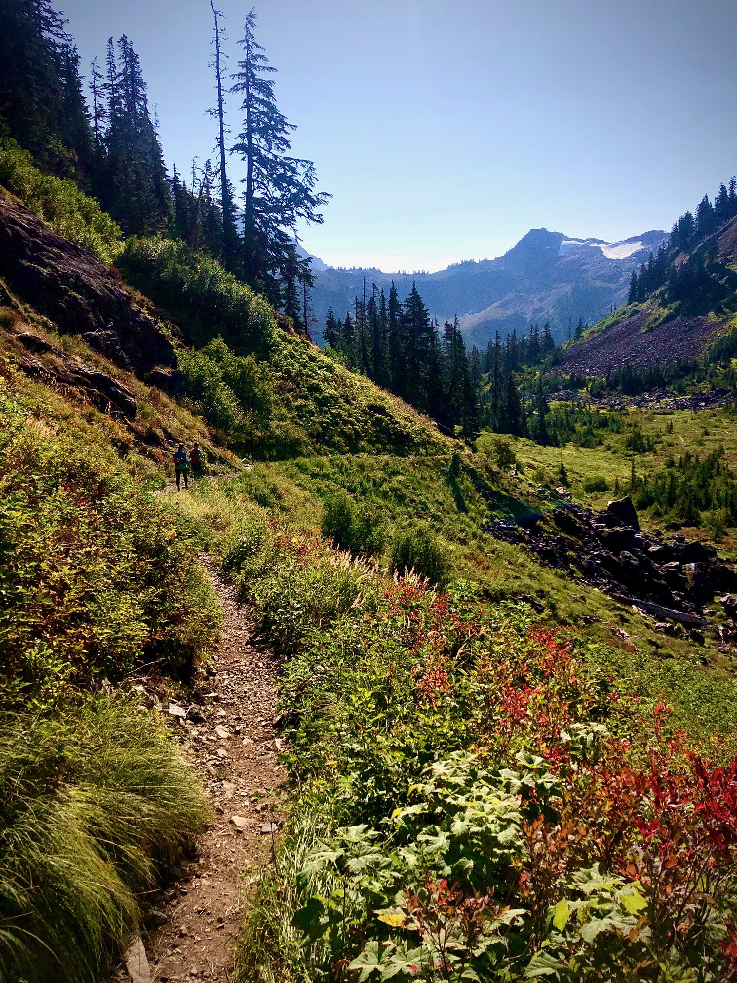
Day 3: Headed back the 9 miles to the car, with a side trip to Buckhorn Lake because I was totally out of water. (Marmot Pass is a dry camp--the last place for water is at the Cooper Creek Campsites. I should have loaded up more, as usual.) So another 10 mile day, which feels just perfect to me. On the way to drop off Twig, she was telling me about her "10 miles before 10 am" ideal. So yeah, I don't see a hiking together future for us...unless she decides she wants to hike in heels. (I bet I still couldn't keep up, haha!) 
I would not recommend Buckhorn Lake


Thursday, September 1, 2022

A Tale of Two Trails


"It was the best of times, it was the worst of times"... if you are a Charles Dickens fan, you'll recognize that as the opening line of "A Tale of Two Cities." But it's not a fitting start to this post, because my tale of two trails only includes the best of times. 

The hiking community has been so good to me. I've connected with the most wonderful people. It really does amaze me, and I could fill this whole page with sappy words of heartfelt gratitude. But I don't want to get all mushy on you, so I'm going to keep this super short and sweet. 

Goofy pics are a must!!


Being lucky enough to have a cabin on Baker Lake Road loaned to us for the weekend, we assembled a girl's getaway plan. Being unlucky enough to have half of our crew nursing injures of various kinds, our plan of hiking Anderson/Watson went out the window.  However, you can't keep hiking girls down! So we improvised and hobbled our way through the half mile interpretative "Shadow of the Sentinels" trail that was just up the road. 

Must take goofy pics everywhere we go! This is the boat launch at Baker Lake

After an amazing night of laughter and "song" (the usual bad singing and ukulele performance you'll get after I've had a few drinks) we awoke to a crystal clear day. Unfortunately though, the girls all had to head home. I left to do the same; but how could I take a right turn on Hwy 20 towards home, when there was still enough daylight to turn left towards more hiking?  


Cascade Pass has been on my list ever since I've had a list. I had been saving it for the perfect trip...maybe to Stehekin...or at least Sahale Arm. But that darn forest road! Every year it seems to wash out - so the perfect trip never happened. Back at the cabin as we were reminiscing about hikes on our girl's getaway,  I was informed that the road had just been fixed once again. So instead of doing Sauk Mountain for the fourth time, I decided to keep on going and finally mark Cascade Pass off the list. I'll end with my "things to know" list below, but if you don't read on please at least know this: DO NOT ATTEMPT TO DRIVE A MASSIVE MOTOR HOME UP THIS CRAZY ASS FOREST ROAD! (Thank God I got around him before the road gets REALLY thin...but OMG, I can't even imagine the shit storm he created for the masses heading down behind me!) Anyway, happy "best of times" trails!


Things to know for Cascade Pass:

1) Expect a LOT of people. But the parking area loops around, so you don't have to settle for the first empty spot on the road you find - unless you really want to walk that extra mile. 

2) There are over 50 switchbacks, though I did lose track. 53 maybe?...and they are some of the longest switchbacks you will ever encounter!

3) Even though they get monotonous, do not cut the switchbacks. I know you already know that, but it never hurts to be reminded. 

4) I didn't start until 12:30 pm and got done at 4:30 pm - which is really fast for me for a nearly 8 mile hike. WTA states this as 7 miles round trip, but they are rounding down (never round down!) and I hiked further over the pass to escape the masses and also had to walk at least a quarter mile to my car.