I got 28 more miles on the Pacific Northwest Trail this past Memorial day weekend. Extra days off work pretty much mean I'm hiking, since it's hard to take time off now that I'm full time with benefits. I'm not complaining, the benefits are a game changer - I'm totally grateful, even if work dampens the free spirit vibe I'd love to permanently live in. Though I dive pretty hard into the fantasy of living wild on the trail whenever I'm doing it; even if it's just for a few days. 
 |
| Osoyoos Lake |
Speaking of doing miles you can't count, I mistakenly did two of those on this trip. There is a lesson I'm struggling to learn, on trail and in life...that would be the "cut your loses quickly by admitting you fucked up" lesson. I did manage to do it early on in the trip and saved myself from sure disaster. A downed marker made a grown over right hand turn nearly impossible to notice. I only realized something was wrong when providentially a Y in the road came soon after and forced me to realize neither direction was keeping me on my Guthooks red line. (Guthooks is a navigation app I discovered when doing my 500 miles of the AT. They changed the name to "FarOut", but I refuse to comply ;)) I HATE turning around, and may have kept pressing forward to try and make it connect somehow (it's over there somewhere...) but the forest started closing in and I knew better. (Video here) |
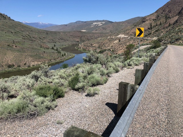
| Whistler Canyon Trail |
But mistake #2 was of the delusional variety; when you want something to be true, so your brain shuts off logic. I didn't want to do road miles, so when I found that the PNT joins the Similkameen trail just outside of Orville, I was quite pleased. And it was a nice trail! Right by the river with surrounding orchards...and wow, it's going to cross on a really cool little bridge! |
| Similkameen Trail |
The thing about FarOut (okay, I'll comply...maybe they will sponsor me!) is it's not always EXACTLY right on. (Which can be frustrating and scary if you have completely lost the trail - like I did on the PNT section from Whatcom Pass to the Little Beaver intersection...story and video...of course this is why you should have real maps as back up. Guilty as charged.) So as I excitedly went down to the cute bridge and noticed I was a little off the red line, I excused it as FarOut's error. "Certainly they mean for me to take this nice little real trail that parallels the road, and then I'll connect back to the road a little further in" my starry eyed self insisted. This is despite the fact the red line does not cross the river - a huge red flag I refused to acknowledge.  |
| Stay up here, dummy |
The worse part about a delusional mistake is the more you commit to it, the harder it gets to admit it. A mile in may not seem too bad, but it really is when deep inside yourself you know; but you won't listen. Sadly I can think of too many times that stubbornness has cost me far more than two miles.
Thank God I finally did pull my head out of my ass and made it back to the road (video) before my support crew drove by to pick me up and couldn't find me - which really would not have been good. ( No cell service, remember.)
 |
| Thank you, Anita and Chris |
A detailed itinerary is below for those interested, but I'll end here wishing you all happy "mistake free" trails.

TRAIL LOG:
Day 1) This was just a travel day, but I mention it here because it's a LONG drive and does pretty much take a whole day if you live in Western Washington. My friends picked me us straight from work at 2pm and I camped with them that night so they could drive me to the TH in the morning.
 |
| Remote camping on BLM land |
Day 2) Got a bit of a late start around noon at the Wilcox TH, which was fine because I only had 8 miles. Very nice road to get there--but the trail itself is not great. Much of it is an active logging road, so I was glad it was the weekend. There is NO camp on this trail I would ever want to stay at except the bench lookout - but it's close to perfect. No water though, so be sure to haul it in. If you go west like me, it won't be hard, because it's pretty much downhill from start to finish.
 |
|
Day 4) The half mile back to the trail, which quickly then brings you to the Similkameen Trail just outside of town. Kind of weird at first, with some dumping grounds along the side, it does become pretty after about a half mile. At two miles you get to what I've read is the more "official" TH, which has a great sign talking about how this is the PNT. That's also part of why I got thrown off; thinking it meant the whole trail was supposedly PNT miles. It is a nice little trail that goes another two miles and ends at the Enloe Dam overlook. (Which does not allow for walking across and connecting to the road, of course.) Anyway, for me, after turning around and getting back on track, I did 8 miles or so - so I'll just say a total of 10.3 so I can call the whole trip an even 28 miles. Close enough ;) |
One of the most poop filled trails I've ever seen.
Lots of Elk and other wildlife in this area. |


No comments:
Post a Comment