


This park is only an hour and half drive from Monterey Regional Airport, so that is where I arranged Ken to fly in. Because renting a car is so expensive, I decided to drive the 16 hours there over two days. I kind of like driving...though having the AC break on me did make this adventure a bit more challenging than I expected.
 |
| My car sleeping game needs improving |
By the time we rolled into the park at around 8 pm, my brain was pretty fried. So don't blame me for forgetting to close the bear locker all the way. Thankfully I had only put the snacks for the car ride in there; but those two midnight raiding raccoons were INTO that bag of chips and M&M's!!
 |
| A quick stop at the beach in Monterey after pick up |
I'm certain I'm not the only one to fail to secure their food properly, because those beasts had to be 70 pounds each. They were honestly terrifying. And though I did finally get them to saunter off by throwing my shoes at them, I had nightmares about them ganging up on us all night.

Things to Know About Pinnacles National Park:
1) The pool doesn't open until 11 am on June 13th. (The day we were checking out of course.) And they won't open it early, even if it is your birthday and you beg.
 |
| We did jump in right before we left...first ones in!! |
2) There are many camping spots that are totally exposed and look like they would be miserable if you were tent camping, but we loved our 19A spot which was very private and well shaded.

3) There is a filtered water dispenser on the outside of the bathrooms which is not obvious.
4) Showers are free! But they do ask you do keep them to 5 minutes.
5) Last but not least - obviously, be sure to secure your food properly. Those raccoons are no joke.

1) I stopped at the Shasta-Trinity National Forest on the drive down (not a National Park, wah) to do an easy 4 mile hike called McCloud Waterfalls. You could pretty much drive to each of the three falls, but the hike is really enjoyable with only about 300 ft of elevation gain.
 |
| The middle one is the best |
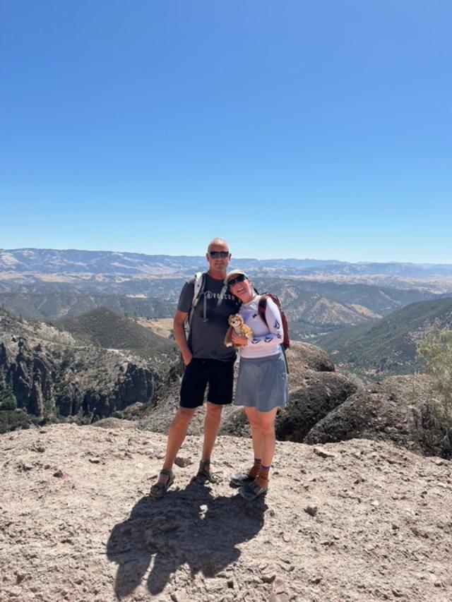
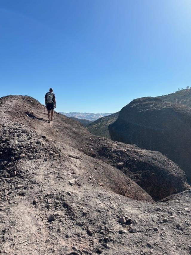
2) Condor Gulch Trail to High Peaks Trail Loop is just a few minutes drive from the campground and is a combo of Condor Gulch/High Peaks/Bear Gulch. Alltrails has this at 5.3 miles and 1.6 K elevation, but it has to be longer - it definitely felt closer to 6 miles at least. Lots of intersecting trails; I highly recommend having a good map or navigational app or you could end up at the West Entrance of the park, which would really be a pain as there is no through road between the two entrances and it would be a long hitch to get back to camp. Also HIGHLY recommend doing this CW, unless you love an endless slog up instead of a gentle grade down. Super fun trail overall, though I was really glad I had my hiking umbrella to help with the heat.


4) Just looking for something to kill the time, we did a "trail" from the visitor center to the Bacon Ranch, which is really just a service road. If you are wondering where the information about the history of the ranch is, you'll find it posted on the side of the visitor center. At less than a mile, this is more like a little stroll, but you will find the world's largest tree burl at the end.
 | |||||
| Okay not literally the world's biggest...but it's big! |
And if you want to watch a full video compilation of the whole trip, you can find it on my YouTube.
No comments:
Post a Comment