
"The best training for hiking is to go hiking," is the one piece of advice I gave my sister when she asked me how to prepare for our future trip together. (It is happening! But I'm still not going to tell you about it just yet.) My friend Heidi is in training for future plans as well, and her go-to hike is Mt Si. I did it with her last year, and it is now in the "one and done" pile for the rest of eternity. But I wanted to hike with her, so I told her I'd find something that was just as hard but not as crowded. Boy did I ever.

Putting in the filters for 8 to 9 miles with 3 to 4 thousand feet of elevation in the trusty Hiker Finder Map on my favorite WTA website gave me shockingly few options...though one trail did come up that is only an hour's drive away from us! Only barely off of Hwy 20, no big forest road to worry about, looked to have some decent views on top...weird that I had never even heard of this trail before.

Reading the trip reports started giving me an idea why. Sketchy stream crossings and of course the punishing incline...but that is what we were after, right? And I knew Heidi would never let a little sketch get in her way. So Cow Heaven it was.

Knowing that in late April you can expect snow around 4,000 feet or so, we understood we'd be running into it at some point. Hoping that the recent good weather had melted enough to at least get us near the top, we brought our snowshoes and spikes and decided we'd just see how it went.
Last minute we both agreed snowshoes are too heavy and awkward to carry, so we only went with spikes. (I have easy to use crampons and she has good micro spikes.) This was a great call, because the last quarter mile or so in the snow was so steep I don't think snowshoes would have worked very well.

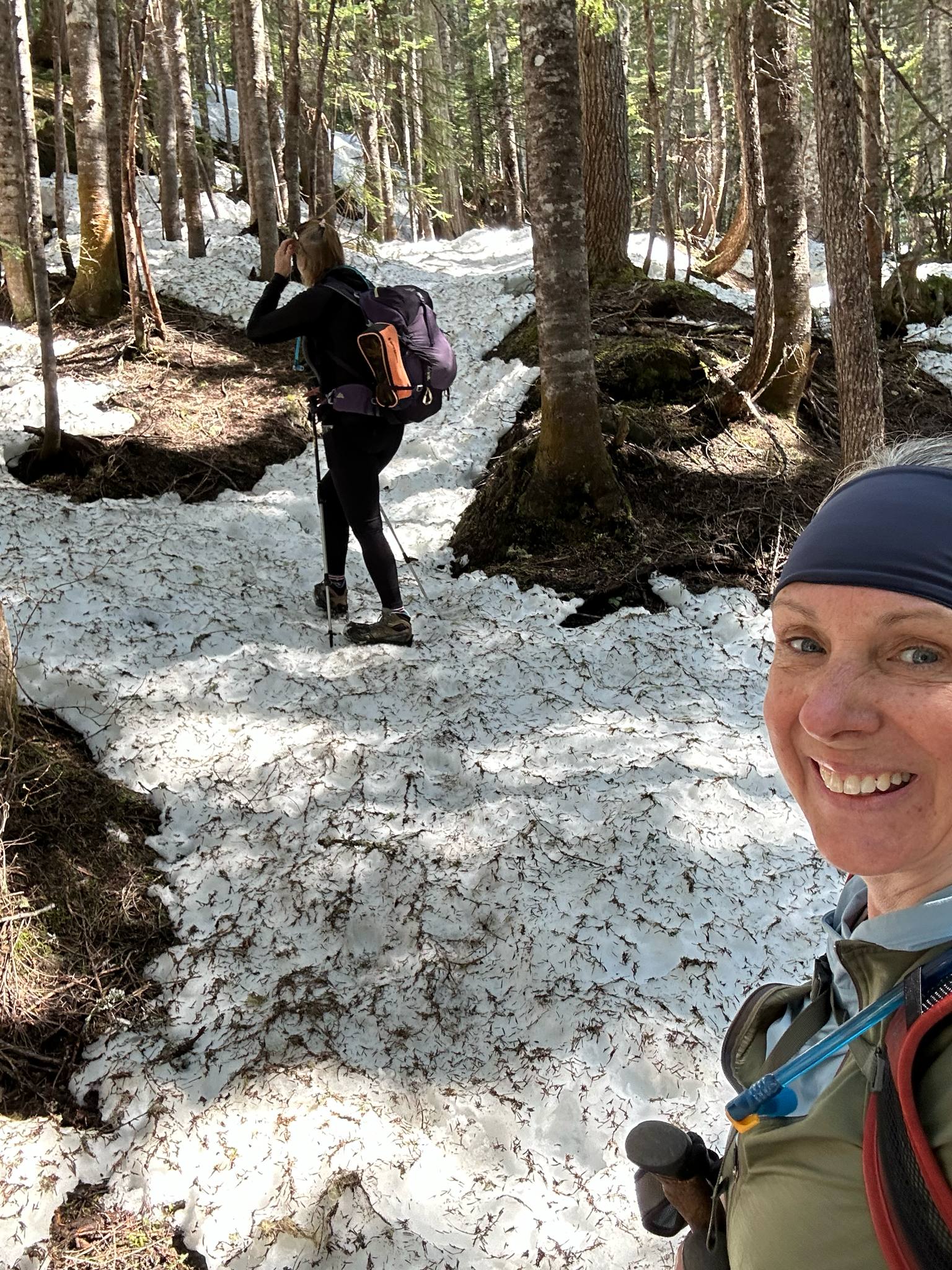
The snow showed up just as we were nearing the 4 mile mark and we started following a lone set of prints. Heidi kept saying "I hope he knows where he's going," and then quickly corrected, "or she" - so from then on we referred to the person as Pocahontas. Of course we'd check in with our GPS to see if indeed we were headed the right way, and for the most part we were. But Pocahontas definitely decided towards the top that switchbacks were no longer necessary.

This is out of my comfort zone and made me slightly uneasy, but it was also thrilling and fun. Plus you only get views at the very end, so we had to make it! We actually enjoyed the adventure so much we chatted about coming back again to see it without snow.

I've always been on the "up is harder than down" team, but the incline did not feel as bad as I feared on the way to the top. The forest is actually quite pretty, with several stunning waterfalls and so much mossy wonderfullness - the four-ish miles flew by. We really expected going down was going to be kind of a cruise.

"Do you remember all these switchbacks?" Heidi gruffed as we hobbled down that God awful last mile. No...no I did not. They felt endless. My body is still mad at me. But we both feel better prepared for our future hiking plans; though none of which will include another trip to Cow Heaven. Happy "one and done" trails! (Video of the hike can be watched here.)
 |
| Sammy loves his new daypack! Read about my old one I had for 12 years here |
THING TO KNOW ABOUT COW HEAVEN:
1) When I say it's less crowded, I mean be prepared to see no one. We did see one couple heading up with ropes just as we were headed down; I'm guessing to climb up Helen Buttes? This is Big Dog territory for sure.
2) The trail is just past the Marblemount Ranger Station and does not have much parking...but like I said, that shouldn't be a problem.
3) That first stream crossing is the only bad one, and it looks worse than it is. Thank you to whomever retrieved the board, because it really is helpful. (Last report said it had washed downstream; but it is back!)

4) We saw no cow spirits, though I guess they really did let cows roam the upper meadows in the good ol' days...but we had to question how they got them up there? It's hard to imagine a herd of cows going up that steep trail!
5) We did not get to the end...maybe a quarter mile more? WTA has this trail at 9.6 miles and Alltrails has it at 8.7? I guess it depends on what you consider the end. We got the views, so it was good enough for us to stop at about four and half miles with 4,100 elevation gain. Even harder than Mount Si.
6) I love the Upriver Grill and Taproom! It's now my place to stop when coming home from the North Cascades.

Sounds like a knee killer! Did you not like Mt Si because of the crowds or other reasons?
ReplyDeleteOverall I felt Mount Si was pretty meh - though the truth is a rarely do any trail twice. Thanks for commenting! :)
DeleteHave you done the Gold mine trail to lost lake in Everson? I did a few weeks ago- didn’t go all the way to the lake (was running out of daylight) but went to the summit and cell tower. Was 9miles 3300’ elevation gain. Local leg killer… erm I mean trainer.. haha
ReplyDeleteI've never even heard of it! I'll look it up!
DeleteMy first and only trip up to Cow Heaven was a very rainy day in 1965. The trail was horrendous and suffering from the herds of cow that had traversed up and down the trail. Mud mud, mud and roots. We continued to make a clockwise traverse around SW Helen Buttes. The route required steep sidehilling and up and over downed trees and wet brush. At the time a used leather logging boots and by the time we reached the car the boots were as supple as a rag and provided no supp0ort. Never again will I return.
ReplyDeleteWow, so you answered my question - the cows really did do the trail! Thanks so much for commenting!
Delete