Wednesday, May 31, 2023

Don't Be Delusional


I got 28 more miles on the Pacific Northwest Trail this past Memorial day weekend. Extra days off work pretty much mean I'm hiking, since it's hard to take time off now that I'm full time with benefits. I'm not complaining, the benefits are a game changer - I'm totally grateful, even if work dampens the free spirit vibe I'd love to permanently live in. Though I dive pretty hard into the fantasy of living wild on the trail whenever I'm doing it; even if it's just for a few days. 

Now that I've hiked most (but not all!) the PNT miles in Western Washington that aren't road walks, I need to venture further east. Thankfully I have friends who frequently travel over the mountains to camp and are willing to be trail support for me. I really don't think I could do it otherwise. It's not like the smattering of remote farming communities have Uber drivers who could take me back to my awaiting car. Most the time there isn't even cell service! And doing up and back hikes when you are counting miles gets pretty frustrating considering you can only count half of them.

Osoyoos Lake
Speaking of doing miles you can't count, I mistakenly did two of those on this trip. There is a lesson I'm struggling to learn, on trail and in life...that would be the "cut your loses quickly by admitting you fucked up" lesson. I did manage to do it early on in the trip and saved myself from sure disaster. A downed marker made a grown over right hand turn nearly impossible to notice. I only realized something was wrong when providentially a Y in the road came soon after and forced me to realize neither direction was keeping me on my Guthooks red line. (Guthooks is a navigation app I discovered when doing my 500 miles of the AT. They changed the name to "FarOut", but I refuse to comply ;)) I HATE turning around, and may have kept pressing forward to try and make it connect somehow (it's over there somewhere...) but the forest started closing in and I knew better. (Video here)

Whistler Canyon Trail
But mistake #2 was of the delusional variety; when you want something to be true, so your brain shuts off logic. I didn't want to do road miles, so when I found that the PNT joins the Similkameen trail just outside of Orville, I was quite pleased. And it was a nice trail! Right by the river with surrounding orchards...and wow, it's going to cross on a really cool little bridge!

Similkameen Trail
The thing about FarOut (okay, I'll comply...maybe they will sponsor me!) is it's not always EXACTLY right on. (Which can be frustrating and scary if you have completely lost the trail - like I did on the PNT section from Whatcom Pass to the Little Beaver intersection...story and video...of course this is why you should have real maps as back up. Guilty as charged.) So as I excitedly went down to the cute bridge and noticed I was a little off the red line, I excused it as FarOut's error. "Certainly they mean for me to take this nice little real trail that parallels the road, and then I'll connect back to the road a little further in" my starry eyed self insisted. This is despite the fact the red line does not cross the river - a huge red flag I refused to acknowledge. 

Stay up here, dummy
The worse part about a delusional mistake is the more you commit to it, the harder it gets to admit it. A mile in may not seem too bad, but it really is when deep inside yourself you know; but you won't listen. Sadly I can think of too many times that stubbornness has cost me far more than two miles. 


Thank God I finally did pull my head out of my ass and made it back to the road (video) before my support crew drove by to pick me up and couldn't find me - which really would not have been good. ( No cell service, remember.) 

Thank you, Anita and Chris


A detailed itinerary is below for those interested, but I'll end here wishing you all happy "mistake free" trails. 

TRAIL LOG:

Day 1) This was just a travel day, but I mention it here because it's a LONG drive and does pretty much take a whole day if you live in Western Washington. My friends picked me us straight from work at 2pm and I camped with them that night so they could drive me to the TH in the morning. 

Remote camping on BLM land
Day 2) Got a bit of a late start around noon at the Wilcox TH, which was fine because I only had 8 miles. Very nice road to get there--but the trail itself is not great. Much of it is an active logging road, so I was glad it was the weekend. There is NO camp on this trail I would ever want to stay at except the bench lookout - but it's close to perfect. No water though, so be sure to haul it in. If you go west like me, it won't be hard, because it's pretty much downhill from start to finish.

Day 3) First 3 miles are rough - a mosquito tunnel, and I'm pretty sure they are just starting to get bad. The campsite I passed would be HELL to stay at - SOOO glad I planned it so I didn't have to. But soon you get to the views, and then before you know it you're at the Whistler Canyon TH after 7 miles total. Then it's about 3 miles into town, and then another half mile off trail to Osoyoos Lake Veteran's Memorial Park. Really nice campground with awesome $18 walk in sites right on the water. FYI, I doubt you will ever need a reservation for those because all of them were open on a holiday weekend. 


Day 4) The half mile back to the trail, which quickly then brings you to the Similkameen Trail just outside of town. Kind of weird at first, with some dumping grounds along the side, it does become pretty after about a half mile. At two miles you get to what I've read is the more "official" TH, which has a great sign talking about how this is the PNT. That's also part of why I got thrown off; thinking it meant the whole trail was supposedly PNT miles. It is a nice little trail that goes another two miles and ends at the Enloe Dam overlook. (Which does not allow for walking across and connecting to the road, of course.) Anyway, for me, after turning around and getting back on track, I did 8 miles or so - so I'll just say a total of 10.3 so I can call the whole trip an even 28 miles. Close enough ;)

One of the most poop filled trails I've ever seen. 
Lots of Elk and other wildlife in this area.


Wednesday, May 24, 2023

Manly Manastache

So this whole weekend was about going ANYWHERE, because Heidi's been working too much. Plus she needed to give her new knee a real test, having had a partial replacement just a few months ago. I wanted to give my new backpack a test too - so we didn't want to do anything too hard, in case either didn't perform quite the way we'd hoped. 

Ancient Lakes is a go to easy early backpack that I haven't done yet, so it seemed a no brainer. Forecast looked good...then even better...then wait, that's a little warm...then hell no, we're not going to that desert wasteland in near triple digit heat. 

Heidi has to take a picture of EVERY flower, haha
She takes good ones though!
So now what? I had already booked a Hipcamp spot for us to stay near Leavenworth Friday night so we would have time to get a Balsamroot experience before heading to Ancient Lakes on Saturday. (And wow, did we get one! Story here ) So needing to find something to fit into our original Hwy 2 / I-90 loop plan, I simply visited the Washington Trail Association page, selected a few filters on their "Hike Finder Map," then clicked away until I found something I liked. (Thanks WTA! They have an app as well, FYI) Manastache Lake looked to be perfect fit, and we only needed to drive about an hour outside of Ellensburg.

The Hipcamp Spot is overpriced, but what isn't around
Leavenworth? And it does have the world's largest firepit. ;)
Though after going "the speed of flowers" all day at Twin Peaks, we didn't find ourselves at our new trailhead until 5:30 pm. Thankfully there was an even easier option of only going 2 miles to the first "Lost Lake," but you know what a super easy backpack-able lake on a Saturday means, right? Yep...we counted a dozen tents in the large area with ALL boys...mostly young boys. Loud, excited, and now free to run wild in nature boys. 

Maybe the boys cleared the trail? Whoever did...
THANK YOU
Believe it or not, there was still room for two old ladies to squeeze in - but we sure didn't feel like we belonged at this party. So we kept moving and PRAYED there was another spot further in. 

Last site on Lost Lake. Thank you Jesus.

With a gorgeous view...but LOUD frogs. 
Maybe even louder than the boys?
We left our salvation spot in the morning and then day packed our way up to see the HUGE Manastache Lake. We made it all the way to the end, despite some route finding and snow challenges - I mean, we had to see the fishing bench I read about on those trip reports.


Of course the camp spot there was already occupied by boys as well...but only two, of the "men" variety, who were kind enough to let us barge through; one even took a picture for us.

Nice guys; though they didn't bring us
 our morning Bloody Mary's as requested  ;P
So the 2 miles to Manastache, then the 2 back to our tents, then the last 2 out to our car made a perfect day with plenty of time to drive home. Both Heidi's knee and my backpack performed beyond our expectations, so we are hoping to get a few other more challenging hikes in this season. My "Things to Know" list below as usual. Happy "get away from the boys" trails! ;)


Things to Know:

1) The last 9-ish mile non-paved road feels like FOREVER because it's badly washboarded and you have to go slow. Any car could make it though, and the parking is pretty large and it has a decent toilet. 

2) This is MOTOR bike territory; probably it's biggest downfall. But we didn't even see one, most likely because the snow isn't fully melted out. So this is the time to go - plus there were NO bugs...but that will certainly change. 

3) There are two (dare I say lovely?) meadows that will be full of wildflowers soon, but no Balsamroot as far as I could tell.

4) The trail is simple to follow, except it has one intersection with signs that only have numbers. Turn left. 

Tuesday, May 23, 2023

Lovely Twin Peaks

Okay, so I wrote this up and then gave it the title...and now it's making me giggle. Sorry - I always have my mind in the gutter. Anyway...yes, the word lovely. Here's its definition:

        1) Charmingly or exquisitely beautiful

        2) Having a beauty that appeals to the heart

        3) Delightful, highly pleasing 

It's not an adjective I use much, maybe never while hiking. The mountains are "amazing" or "breathtaking"...but lovely? That's a word that describes a different sort of chord. But as we hiked the hills of the Twin Peaks trail, we must have said "lovely" a dozen times. Those heart strings that appeal to "delight" and "charm" were being plucked in way that no other hike has. It was a wild flower fantasy come to life. 

And though 95% of the folks on the trail with us were on bikes, every single one of us had the cheesiest grin that shined out like a kid whose lap is full of puppies. Though Heidi and I felt a little like trespassers - invading what was clearly a biker's heaven that us hikers have never heard of. But everyone was so kind and cheerful, I mean, this was the best day ever! As one lady passed us on her bike, she explained that her husband was probably wondering what was taking her so long. "I'll just tell him I was going the speed of flowers," she said with the same ear to ear grin we were all wearing.

Can't stop smiling!
You can never have too many flowers, but you can have too much sun. Poor Heidi hit a wall with nausea and dizziness after we pushed up a very steep short cut to try and get to the mountain view another biker had told us about. 

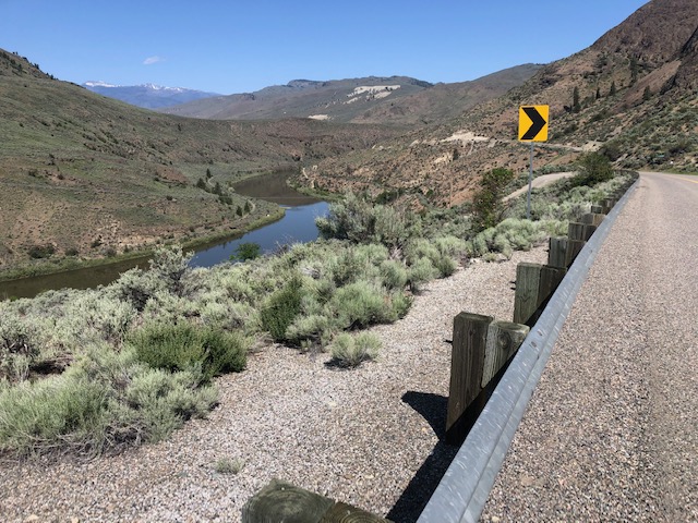
Steep is always hard - but better with flowers :)
This is why I will continue to advise people to use a hiking umbrella. It is so multi-purpose: saves you from rain, hail, sun, and also works great as a peeing shield. Yep, you know how you haven't seen anyone for at least an hour, but as soon as the pants are down...I swear it's a law. (Murphy's, actually.) Heidi wasn't hiding behind any sort of tree; in fact, she was perched up above the trail on full display - like a monument to urination. But, I had her back (or butt in this case) and ran over with my umbrella to save the day. The biker coming through found it quite amusing.

This looks like a good place to pee, haha
I'm coming Heidi! ;)
Speaking of the bikers, the one who gave us directions up to the mountain view also told us not to worry too much about the plethora of intersecting trails because the main "road" is always the "truth" to getting down. That may be true, but according to Heidi's map app she had blessedly downloaded, it was not taking us down to where our car was. Trying to decide from the assortment of trails that would help get us there, we decided "Prepare to Die" was the best choice. What is wrong with us?


As soon as there was a different trail we could veer off on that didn't involve a biker's death wish, we quickly did so before one came through and landed on our heads. Maybe there are rules about "bikers only" areas we were unaware of?


We finally made it back to our car, thankfully without wasting too much time being lost; which was very important because we still had a two hour drive to where we planned to backpack for the night. I'll tell you about that next time; until then, Happy "lovely and death free" trails! 

THINGS TO KNOW ABOUT TWIN PEAKS:

1) Bring a good map or reliable app - unless you are prepared to die, because you could be out there for days. And they are building even more trails!

2) Bring a 4-wheel drive. The bad section of road to the trail head isn't long, but you'll be glad you have one.

3) Don't wear head phones and pay close attention to where the bikers are, then get out the their way quickly. This is clearly their turf.

4) Heat exhaustion is real, and heat stroke can be deadly. Bring lots of water and if you start feeling nauseous or dizzy, find shade and take a break with food and water. (Which we did and Heidi was all good to go.) I know I fared better because of my umbrella, so seriously think about using one! (Plus they make for a cute picture!!)

BONUS THING TO KNOW:

If you want to see some wildflowers but don't feel like driving any further than Leavenworth, there is a strange little "trail" (abandoned road, really) just off Hwy 2 between milepost 92 and 93 called "Tumwater Botanical Area." In my mind, "Botanical Area" means "gardens" but this is most certainly not the case. Don't get your hopes up for anything too "lovely" - though you will see flowers and get a decent work out in. Or you can just go a half mile up and back down like us ;)