Friday, September 13, 2019

Wonderland Fail

Does anything feel worse than quitting? It’s a gut punch to your pride, and it always hurts. But, I do believe there are things that feel worse. Like setting up a tent in a giant puddle. Or pushing up a mountain for 10 hours in the rain while looking at nothing but clouds, even though you know you should be seeing one of the most scenic views in the world. At least I imagine those things hurt worse…I’ll never know, because I choose the gut punch instead. Sure, it hurt for a bit, but thank God I’ve learned not to let my stubborn pride bully me into unnecessary pain for the sake of saving face.

 I’m glad my friends have learned it too. They are a couple smart, strong ladies; and they don’t need to finish The Wonderland Trail to prove it. Though, we are all hoping to conquer those last 30 miles at a time when the weather is a little more cooperative. Until then, I will cherish the 7 days I got to spend trying to go all the way around the most wonderful Mount Rainier.

 If The Wonderland Trail is something you also want to conquer, this custom itinerary planner is super helpful. Link to Planner Or you can steal our failed agenda below. Leigh did a lot of work coming up with a perfect plan for getting the most out of those 93 miles, and it’s hard for me to imagine a better way to do it. Well, except for actually finishing. 😉

On a final note, I have to warn you that if you have a fear of log bridges like I do, this trial will force you to get over it. Too many bridges, of all kinds, for me even to count. Therefore, I am dedicating this poem I wrote to The Wonderland. There can’t possibly be a trail that deserves it more. Happy trails!

My Hiking fear

Is pretty clear

For those darn log bridges

Do bring a tear

I imagine a fall

Cause they’re all pretty tall

And breaking both my ankles

Would sure make me bawl

Just a handrail, please 

It brings such ease

And lightens those fears

That do love to tease

But if there isn’t one

A ford I won’t shun

But if the river I can’t traverse

I’ll creep across that log till I’m done

   LOG:

Day 1: (going counter clockwise)

3.4 miles from White River to Sunrise. Short miles to make up for the time it takes to drive to Rainier makes a lot of sense. Plus these are 3 very steep miles, so it’s nice to give your legs time to adjust. There will be many more tough miles ahead.

Day 2:

13.7 miles to Carbon River. These are varied miles, so it’s not as bad as you’d think. But I will say my feet hurt worse than they ever have after those last 3 miles of hard downhill.

Day 3:

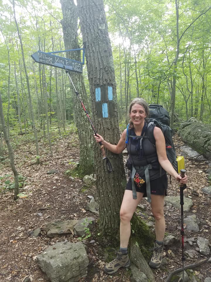
6.4 miles to Eagles Roost. This may seem like a short day, but don’t be fooled. We didn’t get to camp until after 5. Besides being a long climb up, you will want to take your time because you’re in Spray Park. This is a detour off the official trail, but most people take it because it’s so beautiful. And full of bears. We saw 3 this day.

Day 4:

12.4 miles to Golden Lakes. After 2 miles you’ll come to Mowich to get your first food cache, which you’ll need to mail ahead 2 weeks ahead of time. I know it seems like a big pain, but it’s 100% worth it. This is a trail you really want to keep your pack as light as possible. I will also note that I think a 4 day trip from Mowich to Longmire would be a great way to experience The Wonderland without suffering too badly. Reasonable miles, great views, and no resupply shipment needed. Plus there are only a couple log bridges in this section, and they aren’t too bad.

Day 5:

7.8 miles to Klapatche Park. Stunning camp, though seeing a bear on the hill just across from where you’re setting up your tent is a little unnerving. At least all the camps have a bear pole or locker. Be sure to use them.

Day 6:

11.2 miles to Devil’s Dream. Saw another bear after a couple miles, though maybe it was the same bear, who knows. Still unnerving. And if the name Devil’s Dream makes you imagine a camp overlooking a cliff or something dramatic like that, be prepared to be disappointed. Nothing special about this camp, and if it starts to rain a lot, be prepared to wake up in a puddle.

Day 7:

Original plan of 9.3 miles to Paradise River, with a stop after 5.5 miles at Longmire to pick up our 2nd food cache and grab a burger and beer. We had recruited Heather’s husband into bringing our resupply instead of mailing it, and he was wise enough to make sure there was room enough for all of us in the car after seeing the forecast of nothing but rain for the next 3 days. We took him up on it. But not without getting our burger and beer first, of course.

Day 8: (if you are stealing the itinerary)

7.6 miles to Maple Creek. This appears to be some punishing downhill miles, so I’m guessing the shorter miles will be appreciated.

Day 9:

9.9 miles to Indian Bar. Many say this is the prettiest part of the trail…and the toughest to get to. Almost all uphill, topping out at over 5000 feet. I sure hope it’s not raining if I ever get to do it.

Day 10:

4.5 miles to Summerland. Again, this is claimed to be the most stunning portion of trail. Leigh was wanting a short day to take it all in.

Day 11:

6.9 miles back to White River. A nice, easy, short day out. Makes the long drive home not as bad. So smart. Someday it will make an amazing 4 day trip, and then we can claim to have finished The Wonderland…and actually enjoyed doing it.

Wednesday, August 21, 2019

Here Comes Shuffle! (Finishing Section K of the PCT)

 I got a real trail name!!! Yes, I did have one on the Appalachian Trail, but only because I named myself. Talk about a cheater. Even though I got permission from another hiker who had named himself, I always felt a little guilty about it. Even so, KellBell really does feel like I part of me, so I feel conflicted about changing it. Can I have two names? Anish/Ghost does, and she is arguably the best hiker who ever lived. I say, why not? You can call me KellBell, or Shuffle–your choice.

But how perfect is Shuffle? Poncho said it fit not only because of my slow gait, but because of my old school iPod I always listen to when I get too tired and need a boost. She came up with my name on the next to the last day of our six day adventure together in the North Cascades last month. I got to name her too…the day I met her…which was the day we started our hike. Weird, right?

When seeing an invitation on a Facebook outdoor women’s group to join a fellow member on her PCT section hike, I gave it a click to see what was up. “Bramble” was open to all comers to help her complete all of section K, so I immediately messaged her that I was interested. Sometimes you need to be impulsive so you don’t overthink things and talk yourself out of a potentially good thing. Trying to fit in with strangers is terrifying to me, but I knew I shouldn’t pass on an opportunity to do this with others–even if those others might turn out to people I didn’t like, or who didn’t like me. Scary; but I kept my fingers crossed it would be worth it.

Thankfully Bramble was game for me joining up with her a little past the halfway mark. Ultimately she found someone who would start with her, and also someone who would come with me to do half–so the eventual foursome of strangers was set. Bramble, Ranger J, Poncho, and Shuffle…talk about a fantastic 4!

Well, wait…me? Maybe not so fantastic. This trip was such a painful reminder of how slow I am; in fact it was my inspiration for this new blog name! But this group of gals was totally understanding and accepting. They did their thing, and I did mine…my thing being about 2 hours slower than theirs. But it was all good, because at the end of the day, we all made it to the rendezvous spot just the same.

The Fab 4

Even though I love solo hiking, it sure is nice to have a posse to hang with at the end of the day; especially when Stehekin is involved! All my fears about not getting along were completely unfounded. You know the saying, “No risk, no reward?” Meeting these great ladies was 100% worth the risk.

The rundown for this hike is described below, which I will be doing at the end of all my posts…but please understand this agenda is completely different than our original plan. Hiking never fails to be about being adaptable, so remember to always be ready to hike your own hike. Though the truth is, if slow poke Shuffle can do this trip, anybody can. Happy trails!

To read about when I did the first half, click here

LOG

DAY 1:
6.5 miles to camp at a very nice site on Suiattle trail. The 23 mile forest road to the trailhead is a doozy, so consider your car/skills/ patience first. Not a difficult hike though, and so it makes recruiting a drop off team a little easier because it makes a great 1 night backpack for them. Side note: if you are meeting up with someone who is doing the PCT, be extra careful to explain that you are using the camp by the Suiattle bridge and NOT the camp by the PCT bridge only a mile away. I cannot believe there was confusion over this yet again (you’ll have to read that story about Section K’s first half to understand) but I kind of reign supreme when it comes to miscommunication.

DAY 2:
11ish miles to “small stream in a meadow/camping nearby”. There is a sign directing you off trail to the site, and a privy is available, as there was at all the camps. Expect almost all upward momentum this day, but it’s not nearly as bad as I expected. Thus I was able to forgive the speedsters we were meeting for asking us to do 3 unexpected extra miles because they had reached our original meeting spot so much earlier than anticipated. It did make the next day much easier.

DAY 3:
11.4 miles, mostly downhill, to Swamp Creek Camp. Very big area, right next to a big stream. My favorite camp spot of the trip.

DAY 4:
8 miles to the Stehekin bus stop. If you are anything like me, the idea of catching a bus causes anxiety, but don’t worry. I promise it’s totally obvious where to wait for the shuttle, and the schedule gives several options for the day if you miss it. (Look up “Red Bus Schedule for Stehekin” to get up to date times and cost. $8 this year, and they expect you to have exact change.) SO FUN to meet the thru hikers if you are doing this late summer or early fall. And YES, the bus stops for about 15 minutes at the bakery so you can run in and get a treat. Have cash, it will make it easier. Camping is free in Stehekin, and everything besides the bakery is within easy walking distance. “Everything” being: Ranger Station: Where you have to get permits for your next camp spot…unless you can make it to Rainy Pass in one shot. Convenience Store/Restaurant: You’ll need to make your reservation in the store, but the food is excellent. Showers/Laundry: Expensive and probably not worth it unless you’re feeling extra nasty. Post Office: If you want to send a resupply, but you may find everything you need in the larger than usual hiker box. There is also a phone booth that is free, which is nice considering there is zero reception here, or anywhere on this trip.

DAY 5:
11.2 miles to Sixmile Camp. Six Miles from where…nobody knows. But very nice camp, and large, which it has to be. I think I counted 13 tents that night. Sitting in the hiker “kitchen”, you’ll be entertained by all the thru hiker stories if you are lucky.

DAY 6:
8.3 miles to Rainy Pass. FYI, expect rain…it earned its name for a reason. Easy miles–even so, it took me almost 5 hours. The rest of the fab four had been there and waiting in the rain for about 2 hours, so it really doesn’t pay to be fast if you are hiking with me. Again, no reception, so I hope you can arrange your pick up more accurately than we did. My husband made up for the 2 more hours of waiting by bringing us ice cold Coronas to celebrate. He’s the best.

Saturday, June 22, 2019

Lake Dorothy and Bear Lake


The summer solstice strikes each year between June 20th and June 22nd, and much like the “death eaters” are called to their master once the magical tattoo is awakened, the Washingtonian backpackers are summoned once again into the mountains. (Harry Potter fans, anyone?)

We were blessed in 2019 (sorry, I’m still catching up on old hikes) with a forecast of a couple of beautiful days, instead of the June gloom that usually welcomes us on the the solstice. Though, June’s snowline was still low enough to rule out all the “good” backpack options. (Which is usually the case into at least early July.) 

There’s not a lot of talk about Lake Dorothy – or at least it’s not a destination that has popped up on my “must do” radar. But it came up in my searches for June hikes, and I also found it in my 1968 addition of “100 Hikes in Western Washington.” (Under “Snoqualmie Lake” – which you’ll eventually get to if you keep going.)  I did notice that none of these lakes made the cut for the newer 1998 publication, “100 Classic Hikes in Washington” (which I also have, and you should too) furthering my conclusion that this area must be sub-par. 

But beggars can’t be choosers, and Melissa and I were WAY overdue for a trip together, so we set out with open minds to what Lake Dorothy – or beyond – would have in store. 

One ford to consider after Lake Dorothy. Not difficult – just cold.

Besides an easy drive to get there, a huge parking lot with decent bathrooms available were also making Lake Dorothy look better by the minute. We enjoyed our walk together (even if Mel had to continually stop to wait for me) and before you knew it, our almost 2 miles were done and we were there. Knowing we could push on to Bear Lake (and then Deer, before hitting Snoqualmie) and hearing other’s complaints about how bad the mosquitoes had been overnight at Dorothy, we decided to venture further. It’s only another couple miles, but they are much harder with 700 feet in elevation, so as soon as we saw Bear Lake, it was looking good enough. 

It feels like another mile to actually get down to the lake, but it was worth the effort to pass on the first small campsite we came to before making the descent. And we were really glad we passed on Lake Dorothy, as for whatever reason, we didn’t find the bugs to be a problem at all at Bear.

I will be the first to confess confusion over what is legal when it comes to making a campfire, so I will claim the fifth in regards to whether we made one or not. What I will say is that IF you can make a legal fire, and you find everything is wet AF, these fire starters are AMAZING and can make it happen regardless.

Obviously, I was very wrong about this area being in anyway an inferior hiking destination, and I’m not worried that in writing this it will suddenly become overcrowded, because I now know it has always been far more popular than I had realized. In conclusion, I will encourage us all that we need to do our best to take care of our precious hiking areas, to never leave trash, and if you do make a fire, do so as carefully and wisely as possible, using only what is already on the ground. Not that we did that, I’m just sayin’. 😉 Happy trails!

Saturday, June 1, 2019

I DID IT!! AND I WROTE A BOOK ABOUT IT!

It's been awhile since I've gotten back from the East Coast, but I didn't want to post on here until I finished my book. I hope you'll buy it, so you can hear all about my adventure. I think you'll find it entertaining. Plus, I have created a new website to document all the rest of my hikes. (UPDATE...that was a fail, so I transferred the stories on there back to here. Enjoy!) 

You can go straight to Amazon, and search "50 Days, 500 Miles, and 5 States When I Turned 50" and find my book that way. There is a paperback or kindle version available. So with a final farewell to this blog, I will bid you adieu with a photo dump from my 50 days. Happy trails everyone!!!