"Excelsior! Always Upward!" This is the first line on the Washington Trails Association's page for the hike I was determined to do last weekend. Sounds like a call to conquer, right? Plus it's #3 in my 100 Classic Hikes in Washington book; I had to cross it off my to-do list.
Although, trying to figure out exactly how to do it proved to be quite a frustration. Three options are available. #1: Drive most the elevation up to the Damfino Lakes trailhead on a forest road and then hike an easy 3-ish miles to the top. #2: An easier drive to the Nooksack River start, and then do 4 miles of switchbacks to the top #3: A little longer drive to Welcome Pass, with 2.5 miles of switchbacks to the pass, then 5 miles of ridge-walking to Excelsior. My oldest daughter (not a huge fan of upward) was coming with me, so I expected her to demand option #1. She didn't. I just couldn't make up my mind.
 |
| Looked like if you stepped in this moss, it would swallow you up like quicksand |
 |
| Miles of switchbacks, I laugh at thee! |
After about 2 hours we arrived at what was obviously the top, with a little more 'upward' ridges on either side.To our left we saw what I assumed was Excelsior--almost there! But then I noticed a sign that pointed in a different direction saying 'Excelsior'. It seemed weird; but a sign is a sign. Amber was already headed for the peak when I called her back.
"Sorry honey, but that's not the right way." The peak looked amazing, and just within reach; but the same sign declared that way to be 'High Divide'. I had to do Excelsior! So Amber came back, and we took the other trail.
 |
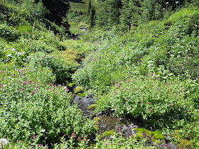
| Still quite a few beautiful wildflowers in bloom |
 |
Twenty minutes of going down is extremely disheartening when you were just on top of the world-especially when you know your going to have to go back up the same way eventually. Enough was enough...it was time to cut our losses and turn around.
Forty minutes of pointless hiking can really take the wind out of your sails. I guess if one was feeling contemplative, they could argue all hiking is not about destination and therefore 'pointless', and I might agree...except when you want to get 'somewhere'. In that case, not hiking in the direction of the specific 'somewhere' feels not just pointless, but counterproductive. Luckily, I brought a little wine to go with lunch; which always eases the pain of being nonproductive. After eating we felt good enough to go ahead and hike to the top of 'High Divide'; even though it wasn't the 'somewhere' we were planning on.
 |
| Is this arrow not pointing to the right? Help me out here. |
 |
| Excelsior, thou hast been vanquished! |
I'm hoping at some point in time someone will explain to me what the hell that sign was all about. (obviously I was looking at it inaccurately...but dang, it seemed pretty clear) After getting back to the car and checking the map in my book, (I didn't want to tear it out to take it with us...when will I learn?) I discovered that had we continued on the trail I thought led to Excelsior, we would have ended up at the start of option #2. (the one with 4 miles of switchbacks-egad!) How ironic that in being so determined to get to a set destination, I was only bringing us farther away from it. I think there's some very deep life lesson to expound upon here; something to do with Dorthy having the magical shoes the whole time...but I'm just too tired to grasp it at the moment.
 |
| Are the arrows not pointing in two different directions? I just don't get it. |
 |
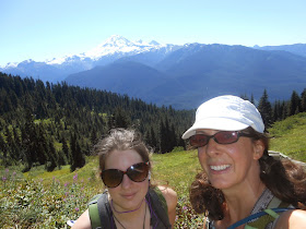
| Amber is contemplating the meaning of Mount Baker |


The wrong turn you took would have taken you 3,900' down to highway 542 and the trail head for your #2 option. That's what it looked like to me when I was there in August. I agree that the sign could have been worded much better. I took it to mean that was was the Excelsior Pass trail.
ReplyDeleteDid you return downhill via the steep path you took up to that top? The other path downhill connects to the High Divide Trail, which you can take back to the junction you were at earlier. The advantage of returning that way is that you get to hike through a couple more slopes covered with wildflower - although they were probably finished blooming by this time. I'm basing that on the time of year and the fact that the picture you uploaded with the corn lily in the foreground was a place that was just covered with blooms in August. This picture - http://www.pbase.com/madhatter/image/156945031 - was taken in a different spot, but at least you can see some of the flowers.